Easy access
Your travel journalis empty
Damn, your travel book is empty!
Please use the buttonto add a place or an event to your favourites!
Morning
Afternoon

Le Crouzat
73190
La Thuile
Locate on map
By car: park in the small car park in the hamlet "Le Crouzat".
04 79 25 80 49
Grand Chambéry Alpes Tourisme
Perfect itinerary for a "big" family mountain hike. Beautiful views, passages under cliffs, a few rocky areas for a bit of scrambling and steep climbs to take the measure of the difference in altitude!
D/ Small parking lot at "Le Crouzat".
1/ Walk north along the road (towards Entrenants).
2/ At the 1st hairpin bend, take the carriageway towards "montagne de la Sauge".
Follow this track to the top of the Entrenants hamlet.
3/ Cross the river, then take the path up to the right.
4/ Make a few zig-zags, then at an intersection, leave the yellow and red path to take a smaller path on the right.
This continues to climb and soon joins a slightly wider path.
5/ Keep climbing.
The path crosses a beautiful beech-fir forest. At one point, the path is no longer clearly marked, so keep going straight up and you'll soon find the track again.
6/ You will then come to another path, marked in yellow.
Leave the downhill path on your right, which you'll use on your return, and turn left. From here, follow the yellow markings.
7/ You pass under cliffs and then a steep climb takes you to the top of the Bévéreau rocks.
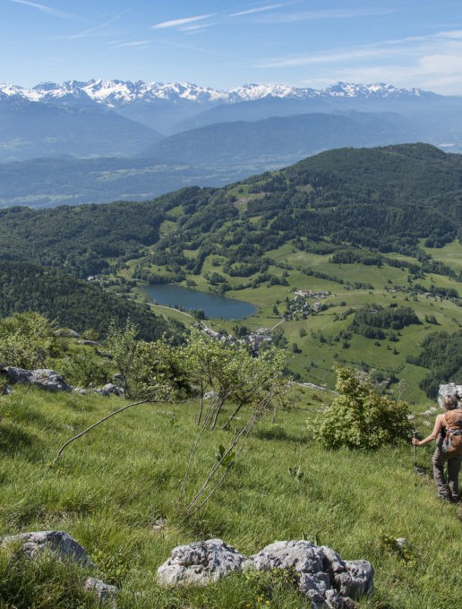
>> The view is superb. Take a break to observe the tranquil Lac de la Thuile, the mountains that surround it and, in the background, Belledonne, the Chartreuse with the Granier, and, further to the right, the Chambéry valley overlooked by Mont Peney and the Croix du Nivolet.>>.
8/ Resume your ascent, following the yellow dots through a maze of rocks.
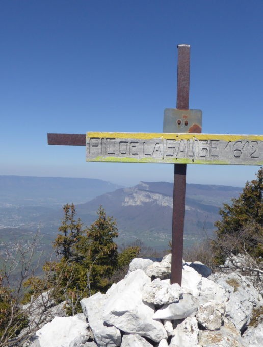
9/ After a few more steep climbs, a good path takes you to the summit of Pic de la Sauge, marked by a cross.
Here you can enjoy the view over Belledonne and the Chambéry valley. To the east, the high peaks of the Bauges appear: Trélod, Arcalod, Arclusaz...
10/ For the descent, retrace your steps to the intersection left earlier. Follow the yellow markings all the way down.
11/ First you cross the cliffs, then continue to lose altitude on a path to the right.
Much lower down, the path catches up with a wide track which takes you back to your starting point.
------------------------------------------------------------------------------------------------------------
When you arrive, please respect the parking spaces provided.
Cars parked outside the spaces are likely to obstruct traffic, emergency services or local residents.
If the parking lot is full, there are plenty of other walks nearby (starting from La Thuile, Curienne, Saint Jean d'Arvey...).
Don't forget to carpool or take the shuttle to the Bauges (https://www.chamberymontagnes.com/randonnees-et-trail/).
D/ Small parking lot at "Le Crouzat".
1/ Walk north along the road (towards Entrenants).
2/ At the 1st hairpin bend, take the carriageway towards "montagne de la Sauge".
Follow this track to the top of the Entrenants hamlet.
3/ Cross the river, then take the path up to the right.
4/ Make a few zig-zags, then at an intersection, leave the yellow and red path to take a smaller path on the right.
This continues to climb and soon joins a slightly wider path.
5/ Keep climbing.
The path crosses a beautiful beech-fir forest. At one point, the path is no longer clearly marked, so keep going straight up and you'll soon find the track again.
6/ You will then come to another path, marked in yellow.
Leave the downhill path on your right, which you'll use on your return, and turn left. From here, follow the yellow markings.
7/ You pass under cliffs and then a steep climb takes you to the top of the Bévéreau rocks.
>> The view is superb. Take a break to observe the tranquil Lac de la Thuile, the mountains that surround it and, in the background, Belledonne, the Chartreuse with the Granier, and, further to the right, the Chambéry valley overlooked by Mont Peney and the Croix du Nivolet.>>.
8/ Resume your ascent, following the yellow dots through a maze of rocks.
9/ After a few more steep climbs, a good path takes you to the summit of Pic de la Sauge, marked by a cross.
Here you can enjoy the view over Belledonne and the Chambéry valley. To the east, the high peaks of the Bauges appear: Trélod, Arcalod, Arclusaz...
10/ For the descent, retrace your steps to the intersection left earlier. Follow the yellow markings all the way down.
11/ First you cross the cliffs, then continue to lose altitude on a path to the right.
Much lower down, the path catches up with a wide track which takes you back to your starting point.
After your hike, take a break at Lac de la Thuile. There's a small inn where you can quench your thirst.
From 15/05 to 31/10.
Subject to favorable snow and weather conditions.
| Elevation gain | 748 m |
| Tricky sections | Passages en bordure de falaises. |
| Complément accueil | When you arrive, please respect the parking spaces provided. Cars parked outside the spaces are likely to obstruct traffic, emergency services or local residents. If the parking lot is full, there are plenty of other walks nearby (starting from La Thuile, Curienne, Saint Jean d'Arvey...). Don't forget to carpool or take the shuttle to the Bauges (https://www.lesbauges.com/itineraire-bauges.html)! |
| Nature of the ground | Not suitable for strollers |
| Cartographic references | Carte TOP 25 IGN 3432 OT MASSIF DES BAUGES |
| Animaux | Pets allowed |
Car park
Free car park
Pets welcome


