Easy access
Your travel journalis empty
Damn, your travel book is empty!
Please use the buttonto add a place or an event to your favourites!
Morning
Afternoon

Parking de la salle du centre socio culturel
Chemin de pré Martin
73190
Saint-Baldoph
Locate on map
By car: park at the Centre Socioculturel du Pré Martin parking lot.
By bus: from downtown Chambéry, take line 3 (towards St Baldoph Centre), line 4 (towards Champet) or line 5 (towards St Baldoph Centre) and get off at the "Saint Baldoph Centre" stop. Further information at synchro.grandchambery.fr.
Reach the parking lot behind the Centre Socioculturel and take the "Chemin de Pré Martin" road.
04 79 33 42 47
Grand Chambéry Alpes Tourisme
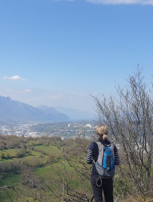
At the gateway to the city, take a breath of fresh air and nature on this hike that's accessible to all! Feast your eyes on a landscape that overlooks the valley and stretches from the Chartreuse to the Bauges.
The route begins on a small road, which you soon leave to take a path through the vineyards. Then, as you climb up through the undergrowth, you'll come across gaps that offer beautiful views of the village below.
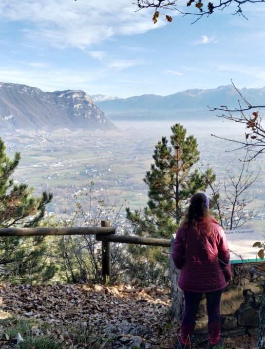
The return trip to the Mont-Charvais reading table is well worth it for the splendid view of the surrounding massifs, from the Chartreuse to the Bauges.
Continue on to the imposing stone cross of La Coche. It was placed there by the ancients to mark the passageway ("coche" in Savoyard) that linked the villages of Barberaz, Saint-Baldoph and Montagnole around the mountain.
You then take a narrow path along the ridge through the undergrowth, where the scent of boxwood accompanies you. At the exit, a surprise awaits you with a superb panorama of Mont-St-Michel, La Galoppaz and the Belledonnes.
You cross woods, meadows and vineyards again, before returning to a more urban atmosphere and completing your loop.
D/ Car park at the socio-cultural center
1/ Turn left onto "chemin Pré-Martin".
At the end, turn left (hamlet of Musselin). A little further on, turn right onto "chemin des sources" and follow "Croix de la Coche".
2/ Take the narrow path alongside a dry stream. At the end of this path, after a few wooden steps, turn right onto the road for about ten metres, then left in the direction of Mont Charvais.
The path climbs up through the undergrowth, offering a fine view of the heights of Saint Baldoph and the Massif des Bauges to the right.
At the end of the path and again after a few wooden steps, the road meets again. Immediately turn left onto "chemin des Miguets", then right onto the wooded path.
3/ At the end of the path, turn right after the imposing old house. Follow the asphalt road "chemin du Château".
After the bus stop on the right, cross the road, then take the path on the left towards "La Croix de la Coche" and follow the path up into the undergrowth.
4/ At the end of the path, turn left towards Mont Charvais (5 min) and take advantage of the viewpoint indicator to admire the view of the Chartreuse on the right, the Belledonne and Lauzière massifs (in the background) and the start of the Bauges Massif with the pointe de la Galoppaz.
Retrace your steps and follow the path towards the Croix de la Coche.
5/ Just before the road, turn right onto the downhill path which, a little further on, runs alongside the sheep park on the right.
At the end of the path, cross the tarmac road and climb the path marked "sentier de la Coche".
Cross the road again and follow the path uphill. Follow the signs.
6/ At the intersection, turn right onto the steep path that climbs to the stone cross (Alt. 618 m).
>> The word coche or cochette used to mean "passage" or "pass". It served as a link between the villages of Saint-Baldoph, Barberaz and Montagnole.
At the foot of the cross, turn right down the narrow path that runs along the ridge.
As you emerge from the undergrowth (boxwood), the panorama of Mont Saint-Michel, La Galoppaz and the Belledonne massif is magnificent.
7/ At the end of the path, turn left, then right and go down through the meadow to the small path that leads off to the left into the forest.
Then turn right up the path at the edge of the woods.
After skirting vast meadows and a few vines on the left, the path continues into the undergrowth.
8/ At the end of the track, turn left onto the path towards "La Porettaz". Go along the vineyards on your left, then continue along the path through the undergrowth.
Go down the small asphalt road.
Cross the D12 and follow the road to Saint-Baldoph.
A few metres further down, turn left between the houses and pick up the path that leads into the forest.
9/ At the crossroads, turn right along a meadow.
Cross the road and pick up the tarmac road which climbs up and passes an old farmhouse.
Further on, the road runs alongside farmland on the left. Reach the church and take the road down to Saint-Baldoph.
10/ Turn right just before the old wash-house and pass the town hall. Continue along this road until you come to the parking area.
All year round.
Subject to favorable weather.
| Elevation gain | 433 m |
| Tricky sections | Le sentier qui longe l'arête après la Croix de la Coche est en bordure d'un précipice. |
| Complément accueil | Hiking shoes recommended. |
| Nature of the ground |
Stone
Ground Hard coating (tar, cement, flooring) Not suitable for strollers |
| Way marking | Balisage GR (rouge et blanc) et balisage jaune. |
| Cartographic references | IGN TOP25 3333OT - Massif de la Chartreuse Nord |
| Animaux |
Pets allowed
Hosting conditions: We strongly recommend that you keep your dogs on a leash, especially when approaching farms. |
Free car park
Car park
Play area
Pets welcome

