Easy access
Your travel journalis empty
Damn, your travel book is empty!
Please use the buttonto add a place or an event to your favourites!
Morning
Afternoon
Parking à coté de la mairie et de l'école
73190
Curienne
Locate on map
04 79 33 42 47
Grand Chambéry Alpes Tourisme
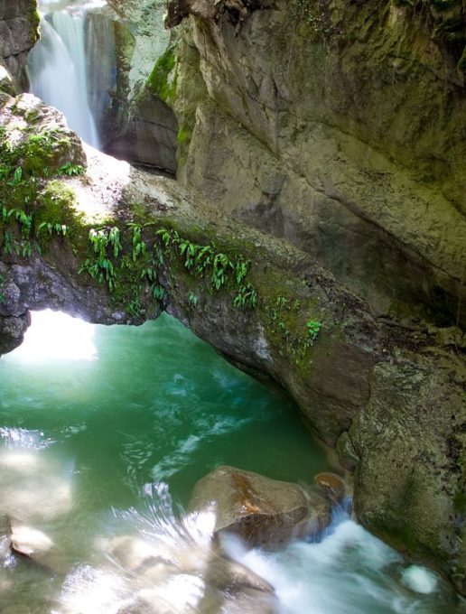
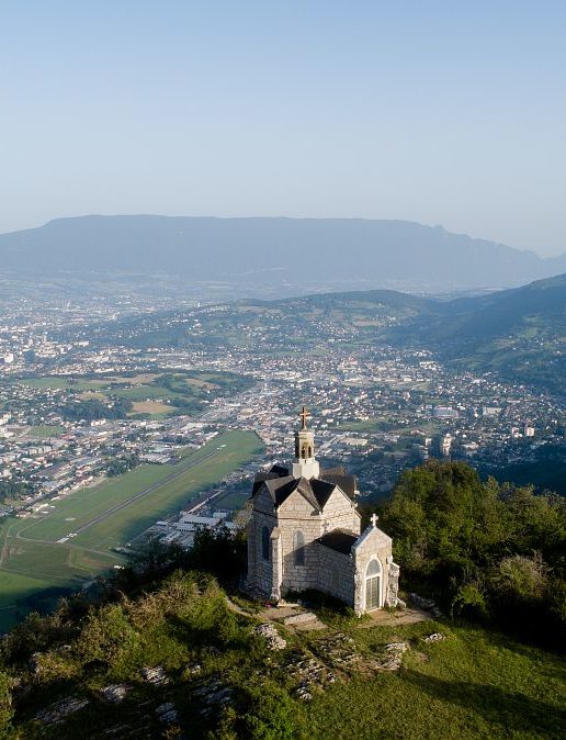
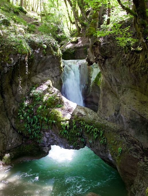
What a superb sight. From the bottom of the canyon, where the waters of the Ternèze make their way and canyonists enjoy themselves, to the heights of Mont Saint Michel, where the surrounding massifs are just waiting to be named, you're in for a treat.
.
D/ Car park next to the town hall and school
1/ Turn right on the D11 towards Barby, leaving the church on your left, go down the route de la Bathie and continue slightly right on the chemin du Moulin to the macrophyte wastewater treatment plant.
The path continues to the left of the plant and leads down to the Ternèze stream.
2/ At the crossroads of the path from La Batie and the Leysse, keep right until you reach the Terneze canyon footbridge, where you can admire the clear-water basins and slides.
3/ Retrace your steps to take the path towards La Batie, which runs along the left bank of the stream. After a kilometer or so, you leave the combe and climb back up a hairpin bend in the road.
4/ Follow the road for a few hundred metres, then in the hairpin turn onto the path that runs through the Grand Bois above Barby.
5/ Gradually gain altitude, reach the stele at the Ferme des résistants and then head upstream around the Camelot gorge. As you go around the bend, you ignore the path leading to La Bognette and La Motte Castrale.
6/ On the "plateau", leave the track leading back to Curienne and continue via "La combe du puits" and "Sous le Mont" to Mont Saint Michel, following the signs.
From the chapel, you can enjoy a 360° panoramic view of the surrounding mountains.
7/ Back at the "Sous le Mont" sign to complete the loop, go straight ahead on the slightly sloping path. At the next junction, take the path to the left of the house, but don't go all the way down to the road.
8/ At the end of the path, you'll come to a semi-tarmac road. Turn left and then right at the sign for "Sur Montmerlet".
You'll arrive at the Montmerlet parking lot. Head to the right of the parking lot, and at the watering hole take the path down to the right.
9/ After a few minutes, you'll reach the road again. Stay on the right-hand side of the road for 100 m, then take the path on the right which takes you back into the woods.
10/ At the road, cross in front on the gravel path, then take the path on the right, towards the wooden sign "direction village".
You'll come to the D11, turn right and follow the road for 150 m. Once again, be careful, as this is a busy road.
11/ Follow the "Chemin de Létraz" on your left, where you'll see a stone cross. Cross the fields and enjoy an unobstructed view of the mountains.
12/ At the road, turn left and follow it until you reach the church, the town hall and your vehicle.
D/ Car park next to the town hall and school
1/ Turn right onto the D11 towards Barby for around 100 m.
Turn right on Chemin du Moulin to the macrophyte wastewater treatment plant.
The path continues to the left of the plant and leads down to the Ternèze stream.
2/ At the path coming from the Sordet bridge, continue to the right past the ruin of the Fontaine Froide mill until you reach the Terneze canyon footbridge, where you can admire the clear-water basins and slides.
3/ Retrace your steps to take the path to the Sordet bridge, which you leave in the combe to climb back up a hairpin bend in the road.
4/ Follow the road for a few hundred metres before taking a path through the Grand Bois above Barby.
5/ Reach the stele, then head upstream around the Camelot gorge, leaving the path leading to La Bognette and the Motte Castrale.
6/ Leave the track leading back to Curienne and continue along "La combe du puits" and "Sous le Mont" to Mont Saint Michel, following the signs.
From the chapel, you can enjoy a 360° panoramic view of the surrounding mountains.
7/ Back at the "Sous le Mont" sign to complete the loop, go straight ahead on the slightly sloping path. At the next intersection, take the path to the left of the house, but don't go all the way down to the road.
8/ At the end of the path, you'll come to a semi-tarmac road. Turn left and then right at the sign for "Sur Montmerlet".
You'll arrive at the Montmerlet parking lot. Head to the right of the parking lot, and at the watering hole take the path down to the right.
9/ After a few minutes, you'll reach the road again. Stay on the right-hand side of the road for 100 m, then take the path on the right which takes you back into the woods.
10/ At the road, cross in front on the gravel path, then take the path on the right, towards the wooden sign "direction village".
You'll come to the D11, turn right and follow the road for 150 m. Once again, be careful, as this is a busy road.
11/ Follow the "Chemin de Létraz" on your left, where you'll see a stone cross. Cross the fields and enjoy an unobstructed view of the mountains.
12/ At the road, turn left and follow it until you reach the church, the town hall and your vehicle.
All year round.
Subject to favorable snow and weather conditions.
| Elevation gain | 303 m |
| Nature of the ground |
Stone
Ground |
| Way marking | Yellow markings. |
| Animaux | Pets allowed |
Car park
Defibrillator
Free car park
Pets welcome
